
There’s a specific kind of freedom in a map with nothing on it. No crate markers, no cabin icons, no quest pips shouting at you from every ridge — just the raw terrain, laid out so you can read it yourself and decide where the wheels roll next. That’s exactly what I want when I boot up over the hill and plan a run, and it’s the whole reason I put together this clean set of high-resolution maps covering all five areas across Valhalla’s Canada and Algeria. Every one of these is 100% unmarked: no crates, no cabins, no quests, no UI clutter. Use them for pure exploration, for plotting a route before you commit, or for dropping your own custom markings as you learn each region.
If you’re still sorting out which rig handles snow versus sand, my vehicles guide pairs well with these atlases — pick your machine, then study the ground it has to cross.
How to Read These Maps
These are clean base maps, and that’s the point. I deliberately keep them free of icons so nothing spoils your first look at a region and nothing clutters the terrain detail you actually need — water crossings, trail lines, ridge shapes, the texture of the ground under your tires. Print them, screenshot them, annotate them, pin them beside your monitor. Whatever helps you build a mental picture of the land before you drive it.
Region 1: Valhalla’s Canada (Maps 1–3)
Canada is where the journey starts, and it eases you in before it starts biting. Three maps, each with its own personality — a friendly forest opener, a balanced ridge climber, and then the one that humbles you.
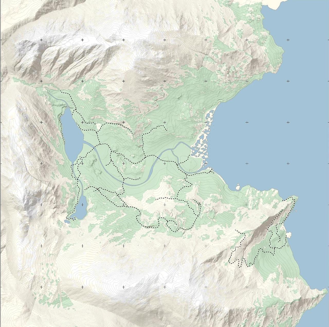
1. Emerald Lake
Biome: Boreal Forest & Valleys
This is the starting map, and it’s a good place to find your footing. Expect muddy forest trails, deep water crossings, and scenic valleys that reward a slow, curious drive. The primary Mechanic shop lives here too, so it’s the natural home base early on. I like Emerald Lake for exactly that reason — it’s forgiving enough to learn the terrain-reading habit these maps are built for.
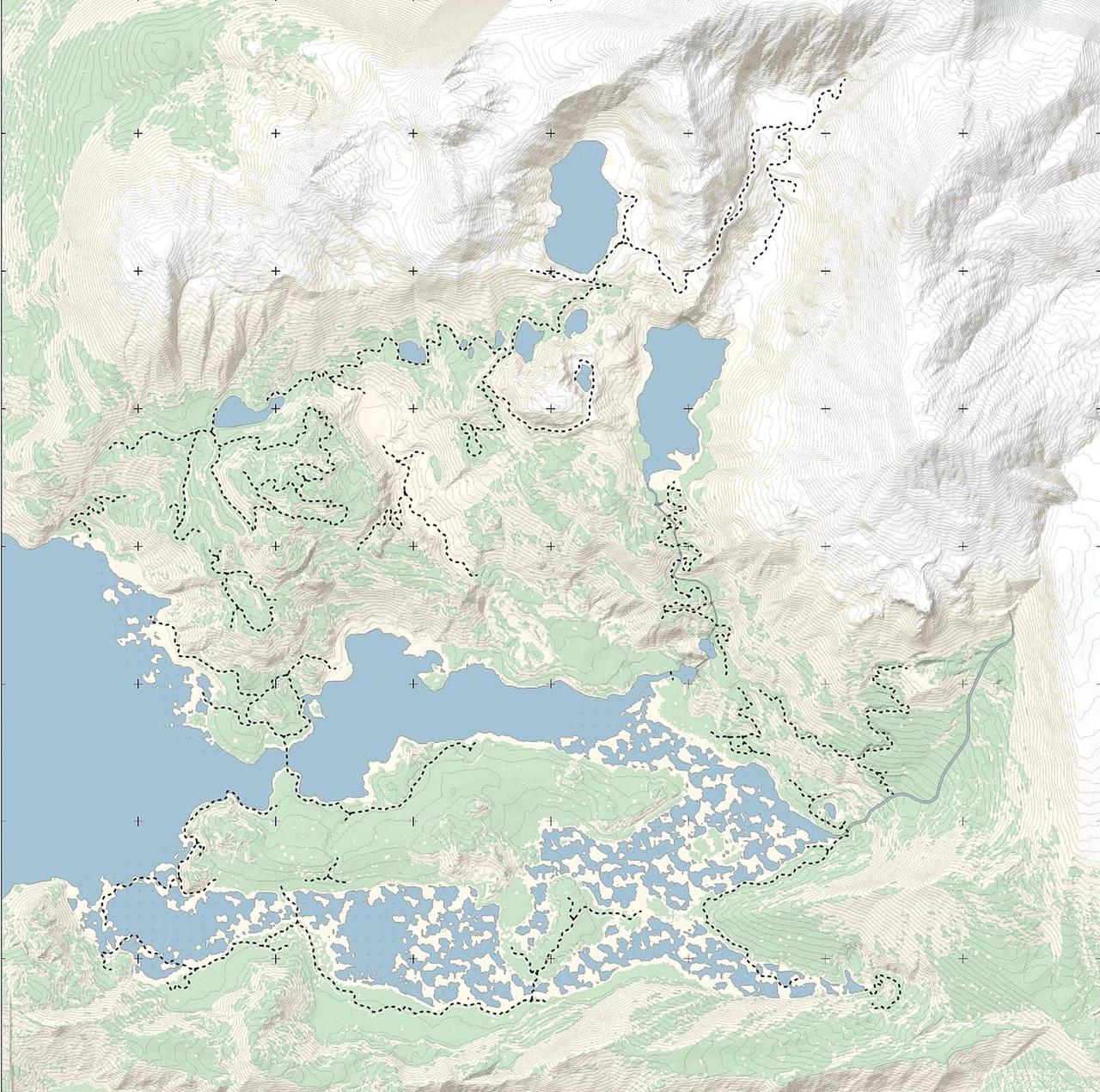
2. Gimli Ridge
Biome: Alpine & Rugged Ridges
Gimli Ridge is the balanced one — flat lakeshores on one side, steep rocky ridges on the other, with complex trail paths that wind up toward the snowy peaks. It’s a genuinely satisfying middle ground because you get a bit of everything in one map. Watch how the trails branch as the elevation climbs; that’s where the route planning pays off.
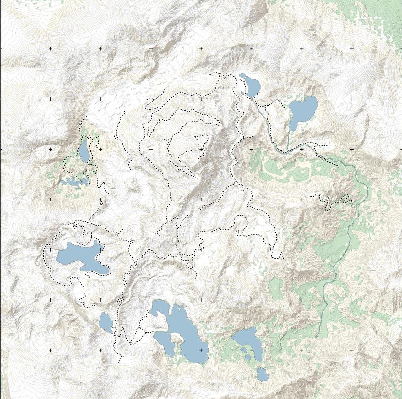
3. Asgard Mountain
Biome: Snowy Slopes & High Altitude
Here’s the tough one. Asgard Mountain is the hardest map in the Canada region, and it doesn’t pretend otherwise — deep snow, ice traps, frozen lakes, and steep mountain climbs all stacked together. I’d study this map closely before a run rather than feeling my way through the whiteout. Knowing where the frozen lakes sit relative to the climbs makes a real difference.
Region 2: Algeria (Maps 4–5)
Once you’ve survived the snow, the desert flips the challenge on its head. Two maps, and both will punish you if you drive them the way you drove the mountains.
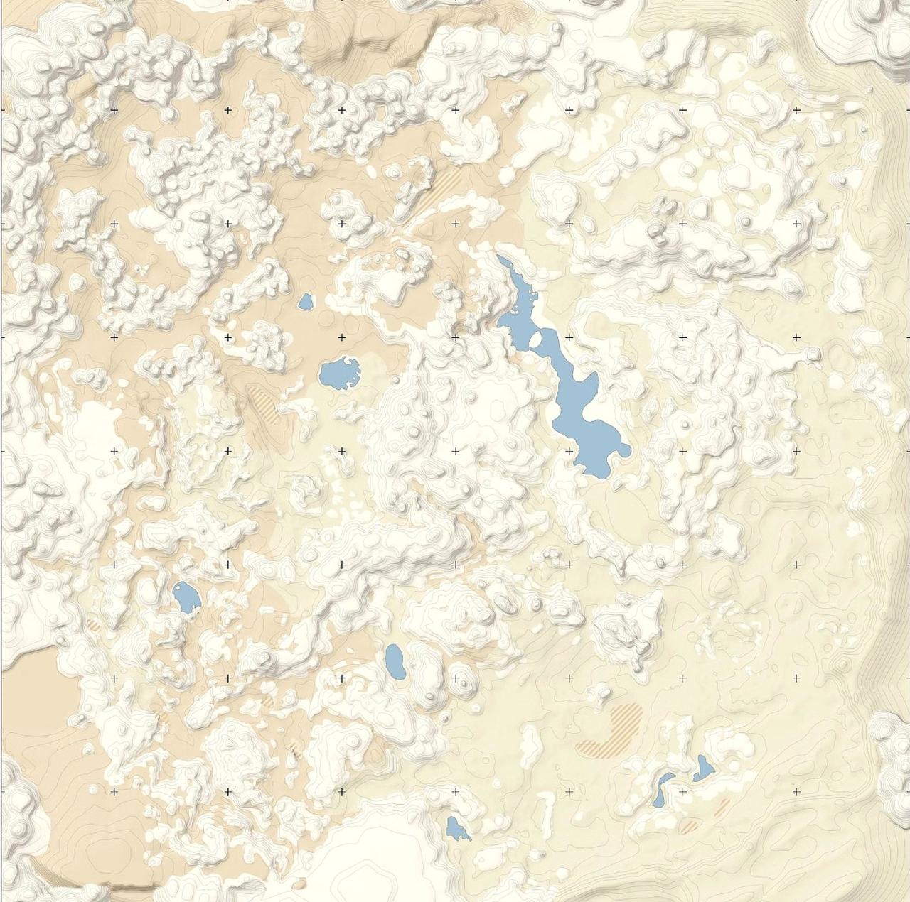
4. Tassili n’Ajjer Desert
Biome: Sahara Desert Dunes & Oases
A massive open desert where the terrain itself is the obstacle. Soft sand physics and steep dunes test your tire traction and your momentum management in a way the solid rock up north never did. The trick I keep coming back to is reading the dune lines on a map like this before I commit — knowing where the steep faces are lets you carry speed instead of stalling halfway up.
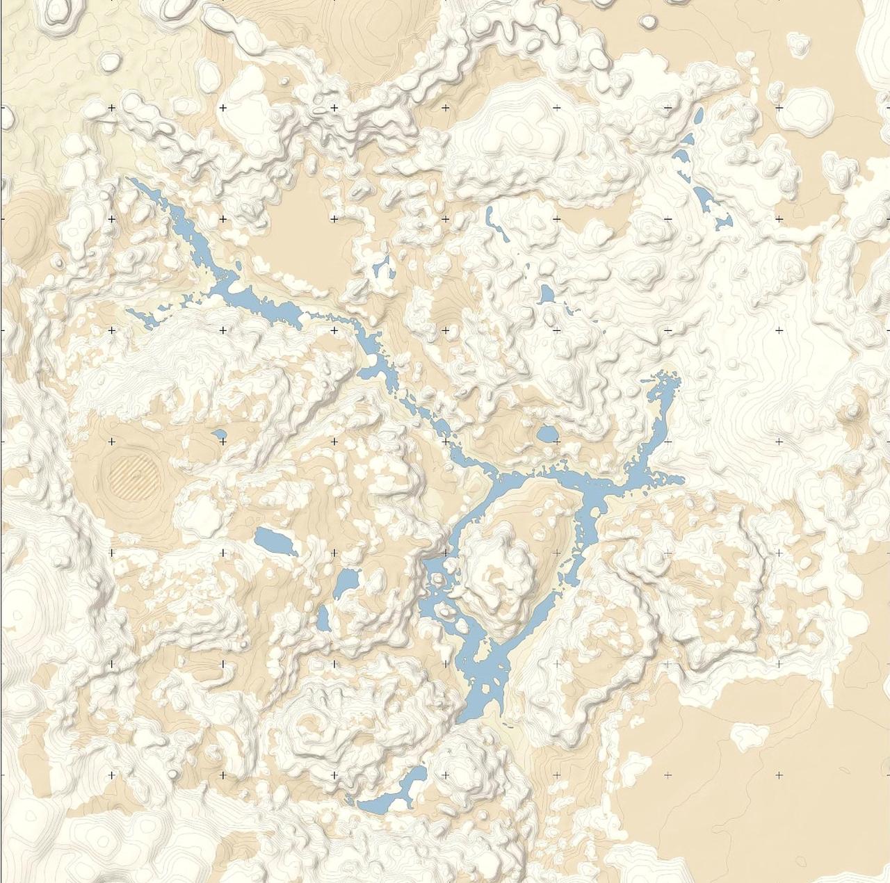
5. Aurès Mountains
Biome: Arid Canyons & Rocky Mountains
The final map, and the most demanding of the whole set. Narrow river canyons, loose brittle stones, steep ascents, and low-visibility dust storms — everything the game has taught you, combined. By this point I’ve usually got my own markings all over a map copy, because there’s very little room for improvisation inside those canyons. Plan the line, know your exit, respect the dust.
Building Your Own Atlas
The real value of a clean map is that it becomes yours. I’ll drop markers for crates, cabins, and quest points as I discover them — but only ever on my own copies, so the untouched versions stay useful as pure terrain references. If you’re charting your own notes, do the same: keep one clean set for reading the land, and mark up a second copy for everything you find along the way. It’s the difference between studying a landscape and doing a checklist, and I know which one makes me a better driver.
Conclusion
Five maps, five very different moods — from muddy forest to dust-choked canyon. Download these, keep them handy, and let the empty spaces do their job. Good luck out there, and drive the terrain, not the icons.